We left Sitka after breakfast on July 12 and headed
north. The day was overcast with rain
showers but as we moved along it lightened up.
We passed the cruise ship dock near Old Sitka and pointed our bow into
Olga and Neva Strait.
 |
| One of many cruise ships that visit Sitka |
 |
| Olga Passage |
Although the
currents meet halfway between these narrow channels, we encountered little
difficulty. As we entered Salisbury
Sound we could see the entrance to Peril Passage opening up to our right and a
couple of boats heading in that direction, hoping to make Sergius Narrows at
slack.
 |
| Rushing to make slack tide at Sergius Narrows at the end of Neva Passage |
We continued on out to sea. As the sound opened up, we started feeling
the effects of the open ocean. A small
swell gradually increased to 4 feet and the 10 knot wind was on our nose.
 |
| Though still chilly, the sun came out and we were able to see some spectacular scenery |
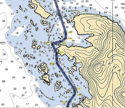
We continued around the Katz Peninsula and entered Piehle
Passage about lunch time. Our local
fisherman neighbour at the docks in Sitka, Cody, had shown us on the chart how
to transit this rock and islet strewn area to spill into Slocum Arm at the
other side.
 |
| I copied this chart - it does not show the exact route, but gives you the idea |
We entered with the swell
behind us and a humpback whale breaching nearby. I stood on the bow to watch for unexpected
obstructions, and Doug steered the course using the electronic chart
plotter. The hardest part of this passage
was paying attention to where we were going as it is an absolutely stunning place
– bringing to mind the Broken Island group on the west coast of Vancouver
Island. The sun was now fully out and
the place just sparkled.
 |
| The rock and islet strewn Piehle Passage |
We only had a few more miles to go to reach Elf Cove at the
head of Ford Arm. What the chart showed
as a shelf, was actually a lovely little bay with tall mountains rising behind
it.
 |
| Ka'sala at Elf Cove |
We dropped our anchor in 10 meters
on the southern side. The water was so
clear we could see a gigantic kelp garden below our hull.
 |
| Underwater garden at Elf Cove |
 |
| Sandy, shell strewn berm in undersea garden and the reflection of the clouds on the surface of the cove |
A tiny gravel crescent beach cupped the head
of the little bay, while spruce, hemlock and pine rose up behind it. We spent an absolutely still calm night and
slept like babies.
 |
| Behind the treeline at the top of Elf Cove |
The next morning was clear and, when I went to the cockpit
with my morning coffee, I could see we were ringed by spectacular alpine
landscape.
 |
| Morning view from the cockpit in Elf Cove |
It was a warm day and that
afternoon, while Doug worked on removing failed Cetol from the teak rails, I
sunbathed in the cockpit. That morning
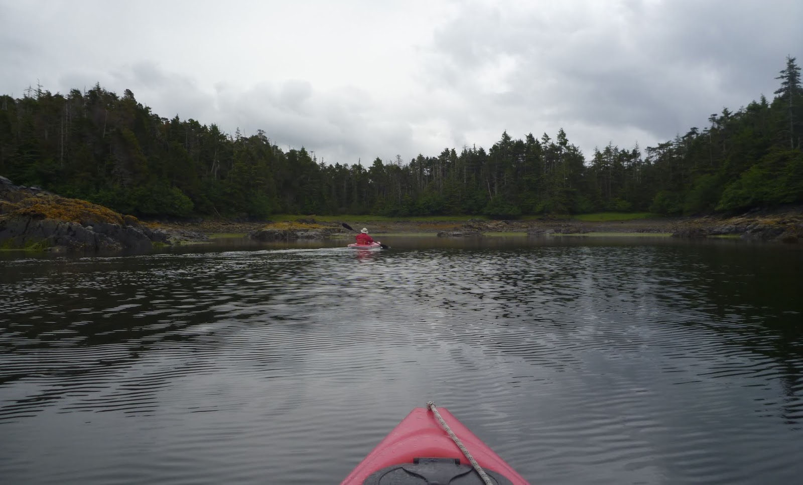
we had launched the kayaks to explore around the head of Ford Arm – the first
time we had paddled since Hawaii. This
time, however, rather than being in our bathing suits, we were in our bicycling
wet weather gear and thermal underwear!
 |
| Doug at Ford Arm |
 |
| On the beach at Elf Cove |
 |
| Elf Cove |
We stayed a second night and then moved farther north,
through Smooth Channel to Klag Bay. We
knew the entrance to that bay, known as “The Gate” had to be transited at a
slack tide. We had timed it to arrive at
low slack, but got there a bit early. We
decided to proceed anyway and had quite a white knuckle ride against a 5 knot flow
which ran through a narrow passage. We turned an abrupt right and entered “Elbow
Passage” where we continued to encounter strong currents and swirls against
us.
Ka’sala was able to make it through,
but it wasn’t one of our more pleasant experiences.
An entire adjacent lake, as well as Klag Bay,
has to empty through these two restricted passages and at times it felt like we
were against water going down a drain. Nevertheless,
we were through it in good time, though it felt like forever! We rounded Klag Island and found our
anchorage in a little bay wedged into it.
We were in a deeper pocket and let out 50 meters of chain.
 |
| Ka'sala at Klag Bay |
It was quite calm in Klag Island Bay and over the next 48
hours the weather deteriorated. We
managed to get in our kayaks to explore our bay and investigate an area that
was supposed to have “abandoned Indian shacks” (didn’t find those, but saw a
newer cabin and several people in small fish boats). Later in the day, while it was blowing over
25 knots just a few miles away, we were snug in our little pocket with hardly a
breeze. The rain bucketed down, but we
were snug with our warm diesel heater.
We spent our time below catching up on our reading and researching our
potential passages and anchorages over the next few weeks.
 |
| Tiny bay in Klag Island |
On Monday, the rain let up and we upped anchor to head to
the head of Klag Bay. An abandoned gold
mine is situated there and we hoped to explore it. We anchored behind a small island, waved in
by a lugubrious sea otter, launched the kayaks and paddled to the top of the
bay where a river tumbles out.
 |
| Anchorage at the head of Klag Bay |
All
around us, running water and small creeks emptied into the bay. The water at this end of Klag Bay was dark
brown and brackish, but surrounded by great expanses of mudflats and tall
grasses. One of our guides said this was
bear country, so we were on the lookout.
It had suggested we carry a pop can full of pebbles to let the bears
know we were nearby.
 |
| Abandoned gold mine ruins on far shore |
We headed back to explore the ruins of the gold mine, but as
we approached, Doug pointed out a large grizzly bear checking us out on the
shore.
Then we saw her two little
cubs. As we got closer, she shooed these
cubs into the tree line, then came back to watch us again. We decided that we really didn’t want to see
that old abandoned gold mine after all.
Instead, we sat silently in our kayaks and observed the mama
grizzly. She was the one to stare us
down and, after a while, we just paddled away, but not before I got a
photo. (Too bad I didn’t have a good
lens!) For some reason, I couldn’t see
how a pebble filled pop can was going to help us if we had gone ashore!
The next day we left Klag Bay at high slack and slipped through the "Elbow" and the "Gate" with hardly a knot against us - a different world!
 |
| Spectacular Smooth Passage |
We continued down Smooth Passage for a couple of hours and anchored at Kimshan Cove - the site of another abandoned gold mine which we also did not explore.
 |
| Kimshan Cove |
We were up early the next morning and crossed Portlock Harbour to enter Dry Pass Bay. We saw many playful sea otters along the way.
 |
| Too cute! |
Once we anchored we launched the kayaks to explore Dry Passage - a small channel leading to the open sea. We wanted to visit the White Sulpher Hot Springs a little farther on, but had been unable to find a suitable anchorage close enough to dinghy or kayak ashore. We thought we might be able to get through a "back door" way from Dry Passage but, once we saw it, we knew it wasn't feasible. Our hot springs dip would have to wait another day.
 |
| Sailboats on the other side of the breakers at Dry Passage |
That evening we were joined by Bob and Dina aboard s/v Silverado. We had been in contact with them over the Great Northern Boating Net and the net controller, Darlene, was keen that we should get together with them. Bob had singlehanded his boat from Mexico to Sitka via Hawaii a few years ago, so we had plenty of notes to compare. We spent an enjoyable evening getting to know each other and hope our paths will cross again.
 |
| Silverado sunset at Dry Pass Bay |
This morning we decided leave Dry Pass and head directly for Pelican, a tiny fishing village in Lisianski Inlet.
 |
| Lisianski Passage |
We arrived at lunchtime and will stay here for a couple of days before continuing on to Glacier Bay. I don't know when we will have internet again, but will post when I get the chance.
 |
| Approaching Pelican |
 |
| On the dock at Pelican |
 |
| The entire village of Pelican is accessed by this boardwalk - it was great to get out and stretch our legs |
 |
| This chart I took from the internet - it is not our exact routing to Glacier Bay, but very close |