Saturday, October 30, 2010

Pelican Bay, Santa Cruz Island and on to Oxnard, Channel Islands Harbour

The next day our plan was to head with Silas Crosby to Santa Cruz Island. We would pass by the famous Painted Cave, the largest and deepest sea cave in the world, which gets its name from the colourful lichens that line its walls.
Painted Cave

Inside Painted Cave

Steve and Meredith hoped to do some kayaking along this rugged and fascinating coastline.

Santa Cruz coastline 

We were to anchor together at nearby Fry’s Harbour but, unfortunately, there was a boat there already and Ka’sala continued on to Pelican Bay.


Fry's Harbour, Santa Cruz

Pelican Bay is one of the largest anchorages on Santa Cruz, but it is still quite small. We put out 50 meters of chain and employed our stern anchor to keep Ka’sala from swinging on the swell. By the time we had settled, it was dark, so we had a quick dinner and went to bed early.

Evening at Pelican Bay

We had really enjoyed an excellent day of sailing in the sunshine along these Channel Islands at 4 to 5 knots, full sails.

Leaving Pelican Bay

However, we weren’t very happy with this exposed anchorage and, with a change in the fair weather predicted, we decided to head over to Oxnard, at Channel Islands Harbour, just south of Santa Barbara and Ventura. It was another pleasant sail, mostly downwind, with main prevented and Yankee poled out. We could see the oil platforms which line the Santa Barbara Channel, but didn’t see any boats as we crossed the shipping lanes.
Oil Platform in Santa Barbara Channel

Playful sea lion in the Channel

We arrived late afternoon and, after checking in with the officious harbor master, were assigned a transient berth close to the end of starboard arm of this man-made harbour.

Entering Oxnard breakwater


Entering the Southern Arm

 We didn’t see any other cruisers and the whole place looked very quiet. Our berth was in front of a Fisherman’s Wharf development that was completely closed down. I fear that Oxnard may have fallen on hard times.

70’s apartment style condos with slips lined the sides as we coasted by.

Fisherman's Wharf in better days - we were moored right on the dock to the left

Next morning, right after breakfast we cast off and continued our journey to Marina Del Rey, 45 nautical miles down the coast.

Wednesday, October 27, 2010

Cuyler Harbour, San Miguel Island

We left Cojo under sunny skies with a delightful 10 knot wind – unfortunately not in the direction we wanted to go, but close enough. We set a broad reach across the Santa Barbara Channel and enjoyed a relaxing sail. After a while we had to head east to reach our destination, so did a power assist to arrive at the anchorage in Cuyler Harbour mid afternoon. As we approached the island, the sun disappeared behind the descending clouds, and it wasn’t until we were almost abeam Wilson Rock that we could distinguish the outline of Harris Point. Through the drizzle we saw the flukes of whales, seals, sea lions, pelicans and many other sea birds. The entire place was devoid of humans, but teaming with wildlife in a scene right out of a movie.


Approaching San Miguel Island in the drizzle

We threaded our way through kelp beds to drop our anchor in 10 meters on a sandy bottom. The water was crystal clear and a translucent green colour. It really felt like we were at the end of the earth – very, very hard to believe that less than 50 miles away millions of people went about their daily business.

Ka'sala and Silas Crosby at Cuyler Harbour

We tucked in behind the bluff which sheltered us from the prevailing westerly swell. On the other side a white sand beach stretched away into the distance and we could hear the perpetual barks and snorts of the sea lions that were sleeping just above the water line.

Beach looking toward where the boats are anchored, Harris Point in the distance

This time, however, we could hear a curious twittering sound emanating from them which we later discovered came from elephant seals.

Sea lions on the beach

Elephant Seals

Soon after we anchored, Silas Crosby joined us and, later, a lobster fishing boat dropped a hook at dusk and was gone by dawn the next day.

Beach, looking away from anchorage

The only fly in the ointment came when a very officious fully armed and uniformed fisheries officer came by to see who we were, why we were there, where we were going, if we had checked in with the Border Protection Agency (division of Homeland Security) and if we were aware of the marine reserves nearby, did we have a fishing license, etc., etc.. He asked the same questions of Silas Crosby, then returned to his high powered boat and roared off into the distance.

Doug at Cuyler Harbour

Next morning, Meredith, Steve, Doug and myself loaded up in Steve’s folding dinghy (I still can’t believe it floats or won’t suddenly tip us into the sea!) and we followed the surf into the shore.

Beach landing at Mutiny on the Bounty movie site - Silas Crosby and Ka'sala in distance

 Both Steve and Meredith are pros at landing dinghies in the surf so we arrived more or less dry. Our only concern was the two sea lion bulls who decided to get into a fight very near our planned landing site. It was pretty spectacular to see them throwing themselves at each other’s chests and making furious growls and grunts. I didn’t see it, but based on the scars I later saw on them, I don’t doubt they were biting each other as well.

We drew the dinghy high up on the pristine beach nearby several large palm trees that had apparently been planted when the harbor was used as a movie set for the 1935 Academy Best Picture production of Mutiny on the Bounty with Clark Gable and Charles Laughton. The sea lions backed off, but watched our every move. When we returned to the dinghy several hours later we could see by the marks in the sand that one of the bulls had slithered over to check it out. We headed off along the shoreline until we came to the path leading to the ranger station high up on the hill.

Steve on the trail

We followed a narrow trail up through a garden of succulent plants, mostly dormant at this time of the year.  We later saw photographs of them in the spring - spectacular yellow blooms, though they look like a wasteland in this picture.


 Along the way we stopped at the monument to Juan Rodrigues Cabrillo, the Portuguese/Spaniard who, in 1542, was the first European to land in the area.


Onward, we continued on to the ranger station, passing the remains of a ranch, with an interesting history, along the way. (If you want more information on San Miguel and any of the other Channel Islands, visit this site: http://www.scifoundation.org/homepage.html)

Isolated ranger station at San Miguel - Harris Point in background

We arrived at the seemingly deserted station perched on a plain high on the bluffs and next to a dirt airstrip. We knocked on doors and finally a young man came out to greet us. It turned out the rangers were away and James Howard, an environmental technician working on the repopulation of island foxes, was there in their stead.

Steve and Jim Howard with fox skull

We spent the next three hours with Jim as he explained for us the history of the island from the early Chumash inhabitants (http://en.wikipedia.org/wiki/Chumash_people for their fascinating history), to the Spanish (http://www.boemre.gov/omm/pacific/kids/cabrillo.htm), the ranchers, the US Navy and, finally, the careful environmental restoration of the island.   Thank you, Jim!

By the end of the second world war, San Miguel was devastated by over grazing and other activities. An ariel photo we saw in the ranger station that was taken at this time shows the island as a huge sand dune. Today, it is lush with succulents and other plants carefully reintroduced and cultivated, as well as the island fox breeding program by the Channel Island National Parks that Jim is involved in.  (http://www.iws.org/island_fox_studies_San_Miguel_Island.htm ). These ventures seem to be thriving as the windswept island is slowly coming back to life (people visiting must stick to the trails and be accompanied by a ranger or designate) and the fox population has increased to about 350 animals, close to the 500 the NPS believes is needed for perpetuation of the species.
Flora reclaiming on the spine of the island

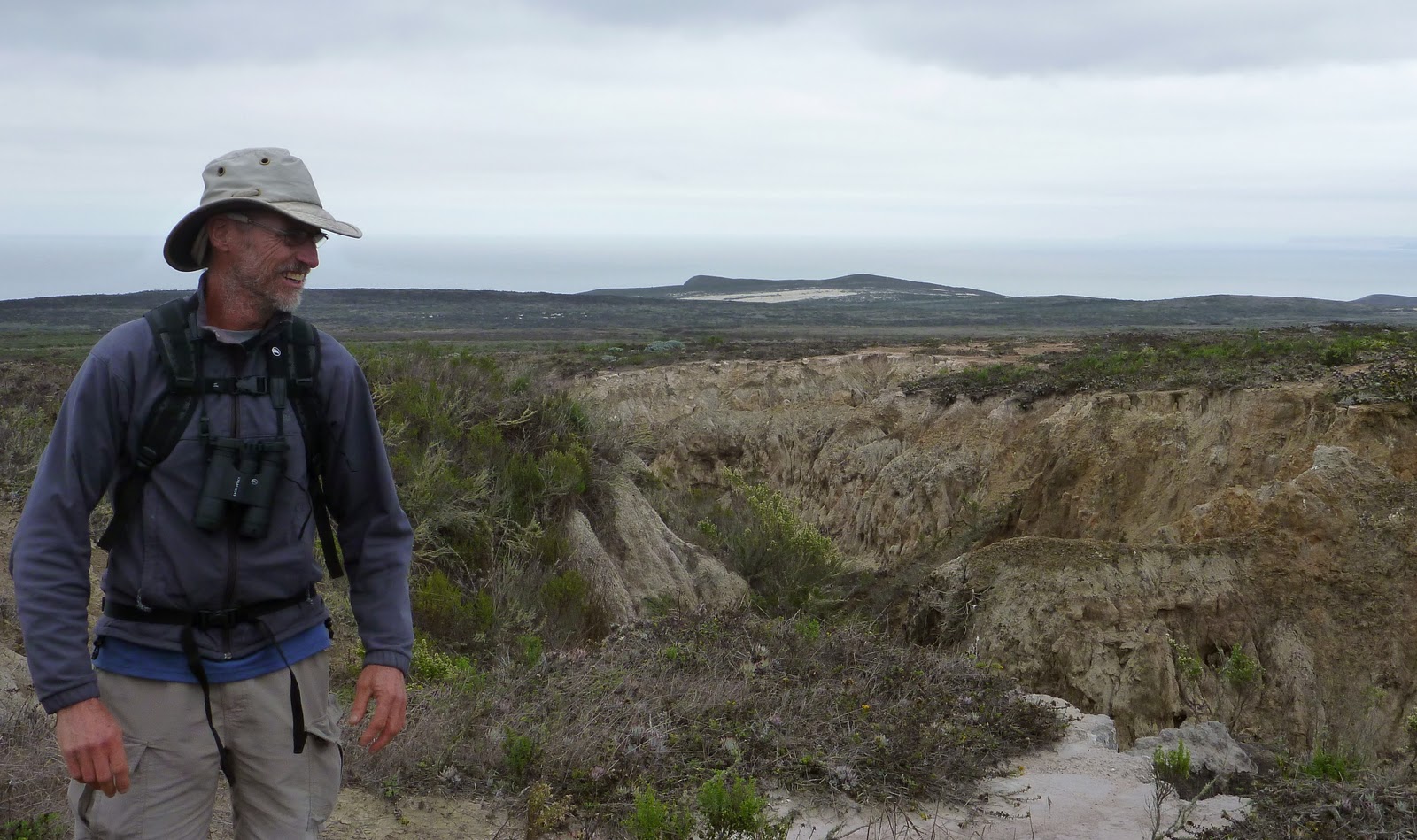
Erosion is still a concern

We wandered over the spine of the island to view the caliche forest to view the calcified forest that once grew all over the island.

Caliche Forest

calcified tree trunk later sighted on the beach

On our way back we watched Jim monitor his foxes with an antennae and a VHF radio, then returned to the station, via the gully, before descending once more to the beach.

Steve at the gully, or was that the "billy"?

The tide was out and we couldn’t resist continuing along the sandy shores, beachcombing, looking in caves, watching the surf and listening to the surge of the waves. San Miguel is a place so special, so unique it is well worth making it a stop en route to San Diego if the weather cooperates.


Natural mosaics

Chillin" on the beach

Thank you Steve for inspiring us to go to this amazing place.

Morro Bay to Cojo Anchorage

We left Morro Bay right after breakfast. The mist was just lifting out of the harbor as we made our way through the breakwater and into the open ocean.

Ka'sala anchored in front of "The Rock"
Silas Crosby and Ka'sala anchored at Morro Bay

Fishing boat at Morro Bay - for my sister

More siblings at Morro Bay

The sun broke through the haze as we raised our sails and pointed the bow in a south westerly direction. The breeze was just perfect and we coasted along at 5 knots, enjoying the scenery as it unfolded before us. In the late afternoon, the wind picked up and we found ourselves reefing the mainsail to balance the helm.

By nightfall we were approaching Point Arguello and the winds increased some more. I felt a little apprehensive about the passage between this point and rounding Point Conception, because it had been given the dubious name: the “Cape Horn of the Pacific”, and was known for high winds. When you look at the chart, the land takes a ninety degree turn here and cruisers say when you pass by you pack away your wet weather gear and break out the bathing suits. Hmmmm - didn't happen. There is no doubt this place a very dramatic geographic area.

As we passed Point Arguello, the wind did, indeed, pick up. We blasted along at 6.5 to 7 knots, peaking at 8 in gusts of 30 knots. It was an exhilarating ride – one I won’t soon forget as the beauty and perfection of the boat and the landscape which made me feel alive in a way that you can only feel in the moment. The moon was full, our wake surged white foam in the moonlight, you could hear the rush of the water against the hull, the wind in our faces, spray all over the place. When we saw 30 knots twice we reefed the mainsail again, which slowed Ka’sala down, and we rounded the “Horn” about midnight. Soon afterward we slipped into Cojo Anchorage and dropped the hook beside Silas Crosby.

Cojo Anchorage

Cojo is a very exposed place to anchor. It is literally around the corner from Point Conception, is very barren, with little vegetation. There are bluffs and sand and the surf pounds against the shore. The swell rolls and the boat rocks.

Silas Crosby at Cojo Anchorage

Steve very kindly pointed out to us the wrecked sailboat on the beach. We spent a very unsettled night and woke up to find ourselves on a lee shore. In the increasing light, we also happened to notice there were TWO sailboat wrecks, not one! We wanted to leave this creepy place as soon as we could, so after a quick breakfast, we hauled anchor and set our course for Cuyler Harbour on San Miguel Island, the most westerly of the Channel Islands group.
Wrecks at Cojo Anchorage 
 (I've scoured the Internet and cannot find out how these sailboats came to rest here)

Monday, October 18, 2010

Morro Bay and memories of Monterey

We left Monterey about 9am on Saturday morning and arrived at Morro Bay at sunrise the following morning.

Baby Sea Lion - Is this the transom you want?

The passage was uneventful, with very little wind and relatively calm seas.

Point Pinos Lighthouse - quite a different story from the 30+ winds we saw here two days before!

The only fog we encountered was just as we approached the entrance to the Morro Bay harbor, though mist and low lying cloud prevailed throughout the passage - just enough to partially obscure the desolate mainland. Our mainsail kept Ka’sala fairly stable throughout the trip, but we missed the quiet of a peaceful sail. Listening to the thumping of the trusty Yanmar for 24 hours takes its toll. We saw very little wildlife, though we had been told that whales were in the vicinity. Just as we arrived at Morro Bay a playful sea lion started chasing our stern, leaping out of the water and barking as if to say: Welcome! (though I think he may have thought we were fisherman coming in with goodies.) The Canadian yacht, Shaman, was in the harbor, as well as the Norwegian, 26ft Contessa, Bikas, though they left for points further south soon after we arrived. Silas Crosby arrived later in the afternoon.
Ka'sala at Morro Bay

You can’t mistake this anchorage. Huge Morro Rock dominates the entire scene. It was apparently named by a Spaniard who thought it looked like a Moor’s turban. Today, this rocky outcropping is out-of-bounds as it is considered sacred by the local natives.

Morro Rock

The entrance to the harbor is on the south side of it and a great long beach stretches out on the other side which is popular with surfers. The town has a beachfront of bars, restaurants and tourist shops. Motels and hotels line the blocks behind, giving away to the main highway with its services and the local housing. Three very high towers in front of a power plant dominate the north side of the harbor front. It is a relatively small town, with a small fishing fleet. Boats are moored in the bay and others are on small docks along the waterfront. The sandbar, which protects it, is supposed to be a great place for collecting shells.

Distinctive power plant on Morro Bay waterfront

I did get to the Aquarium in Monterey before we left Monterey. It is housed in a former cannery and I found it very interesting to read the history of the sardine industry documented there with exhibits, pictures and explanations. As I read, I had Steinbeck’s Cannery Row and Tortilla Flats in the back of my mind. Some of the characters lived in old boilers and worked in the canneries. These displays, as well as the town of Monterey, brought the books to life for me.

Entrance to the Aquarium

Boilers on display at the Aquarium.  Sardines were either boiled or fried, then pressure cooked. Some interesting characters from Tortilla Flats lived in the disused ones.

Tide Pools at the Aquarium

The Aquarium really is a fabulous place to take kids (and there were many of them while I was there). Every exhibit had kid-friendly explanations and manipulatives. About a quarter of the place was entirely devoted to children and they were all very engaged.

Meeting the diver

Big wave - oh,oh!

Hey, this is kind of cool after all!

On display were sea otters, flamingos (yes, flamingos!), seahorses, penguins, octopus and jellyfish.

Jellyfish - we later saw millions of these in Monterey Bay - even our engine decided to eat one causing a bit of concern for the crew of Ka'sala

You should see these guys swim!!

Look closely - this is a seahorse!

There are numerous tanks throughout and two huge tanks – one devoted to life found in kelp beds and the other a giant collection of sea creatures. There are sharks, rays, eels, reef fish of all sorts, predators like salmon and barracuda, fish humans like to eat such as halibut, seabass, salmon and so on. Looking at the giant aquariums reminded me of all the diving I had done in the past and brought back great memories. Everything at the Aquarium is in top-notch condition, clean and colourful. The cost to maintain it must be staggering and, although I originally balked at the entrance fee of $30.00, in the end I think it was well worth it.
Quotations from Steinbeck's books are all over town - this one really captures Monterey

Cannery Row

That evening the showered and tidied crews of Silas Crosby and Ka’sala went into town to enjoy an Indian feast at Ambrosia. It was a little pricy, but the ambiance was gorgeous, service excellent and the food spicy divine. Having white linens at the table was a luxury that brought a certain nostalgia to this particular crewmember.

Not a great shot - still learning how to use my new camera

Tomorrow we plan to leave Morro Bay early in the morning and head to the Channel Islands. Depending on the weather, we will either stop at Cojo Anchorage (just around the corner from Point Conception), or continue on to San Miguel - that means a 12 or 18 hour passage. We will continue to sail with Silas Crosby. According to the guidebooks, once you pass Point Conception, you pack away your wet weather gear and get out your bathing suits. Well, we’ll see. During the passage from Monterey to Morro Bay I had on my wet weather gear and three layers of sweaters underneath. That means a pretty dramatic change – we’ll look forward to it!