Thursday, May 26, 2011

The Big Island, Part Three: Mauna Kea and Kailua-Kona

Our third foray into the island took us across the waist of the Big Island along the Saddle Road. For many years this road was difficult to traverse by anything other than a 4X4, but recent upgrades have made this a very efficient road to travel in a rental car. We left Hilo early in the morning because we wanted to reach Mauna Kea, the highest Hawai’in mountain - an inactive volcano, ringed with observatories, at 13,796 feet - before the clouds obliterated the views and made driving difficult.

Summit of Mauna Kea looking south

We climbed from sea level to the Onizuka Visitor Information Centre at 9200 feet in just under 2 hours.

Visitor Centre

On the way up we must have passed through several climate zones as the landscape changed from the lush gardens around the sea, into forests, old lava beds and undulating pastureland.


Until the last few miles there was very little feeling of climbing a great height as the slope of the land is very gradual. Just at the turn off to the Visitor Centre we could look back and see miles and miles of prairie-like grassland broken up with giant bouquets of lava rock, old volcanic cone heads, with scattered clusters of cattle.


The road up from the saddle was twisty, steep and narrow in places and I could feel my heart rate accelerating with the altitude. By the time we reached the centre (the farthest you can go without a 4X4), I was experiencing shortness of breath and a bit of nausea. Doug, with his fighter-pilot blood, felt fine.

The original Hawai’ins view Mauna Kea as sacred. They call it “the place between heaven and earth” and believe it is where their original god created humans. The volcanic goddess, Pele’s, sister, Poliahu, resides there and many rituals have taken place over the years. There is a little lake near the summit where the people have placed their baby’s umbilical cords to protect them as they grow. Royalty went to the top to commune with the gods. When you are there and feel the mountain air, there is no doubt in your mind it is a special place.

It was chilly up there and our light clothes were inappropriate. (In fact, it snows on occasion and locals flock up to slide and board when it happens.) We quickly scuttled to the info centre where we found displays explaining the various stellar observatories found at the top, as well as details about the geology, history, flora and fauna of the area. On certain nights, the centre offers star gazing through some pretty serious telescopes we saw put away for the day. There was also a little gift shop. We contented ourselves with watching a short film about the summit and observatories and browsing the displays. If we were more suitably dressed, we could have taken several short hikes around the centre and even taken a tour of the summit. However, once again, we were pressed for time, so opted to continue along to the western coast.

The Saddle Road on the western side of Mauna Kea is well paved, but very narrow and, in many places only a single lane, so we took our time descending. We were rewarded with spectacular views of the sun-dappled landscape far to the south and north where the land seems to just drop into the water.


We arrived at Kailua-Kona, but continued south along the coast highway as far as the village of Captain Cook to view the famous bay there and his monument. The area along here is very steep with houses and gardens literally precariously perched along the cliff sides.

On the coast we arrived at Kealakekua Bay State Historical Park thinking we could park the car and walk to the monument. Unfortunately, we could not figure out how to do it so, instead, took a quick look at the beautiful bay which was busy with many kayak outfitters.

Captain Cook Monument across the bay

Apparently there is good anchorage here, but it was hard to tell from the shore. I could see the monument in the distance and thought about the circumstances that had brought about the death of Cook.

Captain James Cook

Cook first arrived at the Big Island during the four-month Feast of Lono, god of agriculture, when all warlike activities were suspended. Consequently, the people were in a friendly and receptive mood. Some stories say the Hawai’ins thought Cook might actually BE the god Lono and, when you realize he was the first white man they had seen, combined with his otherworldly ships, it was no wonder. At any rate, they feted him, many gifts were exchanged, and the sailors had a field day with the women who would apparently sleep with them for nails (Cook had to make sure his ships weren’t torn apart by his over-eager men!).

After provisioning, Cook continued on his journey, but encountered a storm which brought down one of his ship's masts. He returned to the Big Island, but this time his reception was not as welcoming. As he repairs were made to his ship, relations with the locals went from bad to worse, culminating with the theft of one of the longboats. Cook conspired to hold the local chief aboard his ship until the boat was returned – a ploy he had used successfully several times before. Unfortunately it backfired and, as Cook was enticing the chief aboard the boat, there was a skirmish. In the scuffle, he shot one of the warriors which set off a rampage. Within minutes Cook and his escort were beaten and clubbed to death by the mob.

To say the least, everyone was horrified by what had happened. To make amends, the Hawai’ins wanted to give Cook a burial worthy of one of their kings. Unfortunately, that included carving up the body and placing the parts at various secret locations to keep away bad spirits. You can imagine what the British officers thought about that! They demanded his body back so they could give it a proper burial at sea and apparently, everyone had to compromise, because only parts of Cook could be recovered.


What makes this story even more significant for me is that I had an ancestor who was on one of Cook's ships. Joseph Coleman, born in Surrey, England, in 1751, was signed aboard the Discovery in 1776.  During the journey he became Quartermaster and attained the rank of Petty Officer.  He was aboard when Cook was killed.  Interestingly, George Vancouver and William Bligh were also present on that journey.  I have my Dad to thank for this information.  He wrote a novel based Joseph Coleman's adventurous life at sea, not only on Cook's voyages, but also aboard with Bligh during the infamous mutiny on the Bounty.

After all the morning’s adventures we were VERY hungry and thirsty and, lo and behold, our guidebook indicated there was a micro brewery with a restaurant in Kailua-Kona! If we could have flown there I don’t think we could have got to the Kona Brewing Company fast enough!


We had salad, shrimp toast and pizza along with Fire Rock Pale Ale for Doug and a Lavaman Red Ale for me. Wow!


On tap at the Kona Brewing Company

We sat out on a large patio surrounded by lush plant life.


The place was packed. As we left we stopped off at the growlie and bought a little brown jug of Castaway IPA to share with sailing friends later.

An unfortunate name for beer thirsty sailors

Later we drove along the Kona waterfront lined with cafes and restaurants. The place is geared to tourists and we saw many of them exploring the town and shoreline. Doug wanted to get to the marine store we heard was at the marina at Honokohau Harbour to buy some varnish and see what stock they had. We were disappointed to find there were few sailboat supplies as they mostly catered to fishing boats. We didn’t find what we were looking for but were, however, able to buy a Hawai’in flag courtesy flag. The marina itself is all stern tying and filled with fish boats. We only saw a handful of masts.

Hawai'in Flag

It was getting late again and we still had to traverse the Saddle Road to get back to Ka’sala. We left the west coast at about 4pm and, as we headed back up the mountain, we were soon engulfed in the clouds and we had to pick our way along the narrow road watching out for invisible cows. :)


We burst into sunny skies at the highest point, then descended again into clouds and rain before finding our snug berth on Ka’sala again.

The Big Island, Part Two: Volcano!

We had read that there was an active volcano and we thought: Cool! Let’s go there! It seemed like a good idea, but as we got nearer to Hawai’I Volcanoes National Park we started having second thoughts. What are we doing visiting an ACTIVE volcano? One that could erupt at any time. One where the boiling magma was just a few hundred feet under the earth. The biggest one on the planet? Were we crazy? Then again, we had just crossed the Pacific in a 34 foot sailboat, and would do it again in a few weeks time, so perhaps we were nuts after all!

An earlier eruption of Mauna Loa
The Hawai’ns believe that the goddess Pelehonuamea, affectionately called Pele, lives in the active Halema’uma’a Crater partway down Mauna Loa. When her temper or jealousy flares up, so do the eruptions and the consequent lava flows. There are many stories and legends surrounding these events which remind me of Greek mythology. Whatever the belief, beyond a doubt, this massive volcano is very impressive.
The goddess Pele

After paying $10.00 at the park gate we checked into the visitor centre.


There were several displays, numerous rangers answering questions and making suggestions, a small theatre looping four short films about the area and a gift shop. I thought there would be thousands of tourists here and was surprised to find only a few dozen cars and about 50 people milling around.  (www.nps.gov/havo)

We watched the films and the most surprising thing we learned was that the Hawai’in Archipelago is still growing. Acres of land are being created on the south end of the big island as the lava flows into the sea, cools and creates more mass. To the south of the big island, and under the sea, is another volcano – Lo’ihi - which is erupting and pushing its way to the surface. Someday it will become the newest Hawai’in island. Each of the islands in this archipelago has gone through this process and the shifting of the earth’s plates has moved them, like a conveyor belt, four inches a year to the northwest.

We returned to the car and continued along the Crater Rim Drive which circles the caldera. The air all around was very misty and was referred to as “vog” – volcanic fog filled with sulfer dioxide. Unfortunately for tourists, this vog has increased in its density in the last few years creating dangerous levels of gases and causing most of the area around the crater to be closed to the public. We were able to stop at the steam vents to see plumes of vapour pour out of fissures and cracks.

The steam rising up from this vent was hot - why are there no spas here?


Steam vents rose all across this field

We walked along a path to the rim of the crater and were able to see right across its expanse. What a sight! My heart rate was definitely high as I looked across this moonscape, imagining the power that lay just below the surface.
Blonde Pele at the side of the cliff - crater in the background

We continued on and stopped at a small outlook which showed the cliffs we had looked over by the steam vents. It was a pretty spooky feeling to know we were just feet from the edge.

From the steam vent viewing area

Looking back to the steam vent viewing area - we were very close to the edge

Further along we came to the Jagger Museum – a small interpretive centre – where we could read more about the volcano and the research it has garnered over the years. On a platform, outside of the building we could get a better look at the crater, but on the day we were there we could only see the smoke rising.


Apparently, if you came at night, you could see the glow of the lava in the smoke. Apparently there had not been an eruption for several months and the last one had been quite small. There was another little gift shop here.

Unfortunately for us, the road also ended here, closed because of the sulphur dioxide gases, and we were forced to retrace our tracks. No spewing rocks, towers of lava or flow for us! We tried to decide if it was a good or bad thing – especially after seeing the footage of eruptions and flow in the films at the visitor centre!

Another option for us was to continue our exploration of the park by driving down the Chain of Craters Road to the sea. This is a 36 mile round trip where, at the halfway point, lava has crossed the road, severing it from continuing on to the south westernmost communities of the big island. Alternatively, if we had brought our hiking shoes and a jacket (it was quite cool), we could have walked through a secondary crater called Kilauea Iki, or chosen from several other trails that wound around the area. We wanted to continue south to Ocean View, so decided to leave these options for another day.


Doug had been in touch with Randy of the Pacific Seafarer’s Net and we were heading to Ocean View, where he lives, to have lunch with him and his wife, Lynn.

Randy

They have a lovely home which seems to naturally rise up from several acres of lava rock, garden, lava tubes and tunnels and has stunning views over land that slopes to the sea. In the distance, the ocean and the sky seem an endless expanse of blue. They run a very efficient bed and breakfast, with three bedrooms, called Leilani B & B. (http://leilanibedandbreakfast.com/)

Lava tube on Randy's amazing property

After lunch at the local bakery, Randy showed us around his unique property and a tour of his radio workshop.


The technology he uses to participate in the Seafarer’s Net is very impressive and we knew we would be able to picture him there when we talk to him on the passage home.


We expressed our gratitude to him and his radio mates for their dedication to the Net. Those voices on the Net are like a lifeline to us when we are at sea. Thank you very much Randy, Jane, Tom, Russ and all the others who support the Seafarer’s Net each night. You are making a difference!

In the late afternoon we headed back to Hilo. We decided to check out the extreme south point of the island and followed a twisty, windy road through pastureland that gradually sloped down to the sea.

The rugged most southern point in the US

As we approached the water we saw an area of wind silos – some dilapidated and no longer serviceable, with more modern, working ones in the distance.

These windmills always give me the science fiction creeps

The road deteriorated into a potholed track as we approached the cliffs at the end. There were quite a few cars down there and we could see kids jumping off the cliffs and climbing back up rope ladders to do it again. The water was turquoise clear at the southern most point of the United States.

Cliff diving in Hawaii

We continued along the pocked road which seemed to branch out all over the place. When we saw the foundations of old buildings we began to realize that the area must have once been some kind of military base. (We later found out it was a Pacific Missile Range Station that tracked missiles shot from California to the Marshall Islands). We reached the end of the road where there were many more parked cars whose occupants, we later learned, had hiked the 2km or so, to Green Sands Beach, coloured that way because of olivine sand that had eroded from an ancient volcanic cone nearby.


Green Sands Beach, South Point, Hawaii

The day was getting on, so we turned around and retraced our steps, once more, to the highway.

A few miles further, we stopped at Punalu’u – a black sand beach that is apparently famous for basking green sea turtles. We didn’t see any turtles, but were amazed at how BLACK the beach is! There were quite a few local people here picnicking and fishing, as well as tourists strolling the beach.

Now that's a black beach!

Time was getting on and the rain was setting in, so after a brief look around we climbed back into the car for the last leg to Hilo. Through vog and rain, the landscape undulated from very bleak mountains of jagged black lava rock to lush, green, hilly pastureland.

Black lava landscape

We were happy to return to the snug cabin of Ka’sala and tip a glass to my sister whose birthday it was today!
Happy Birthday, Darlene!

Tuesday, May 24, 2011

Hawaii, The Big Island: Part One

Ironically, we didn’t sleep that well our first night in calm waters. We had been at sea long enough for our bodies to become accustomed to the constant movement and our nightly watch patterns. One night was not going to change that!  I also found it very humid, warm and close. We woke early the next morning anxious to clear customs so we could explore, do laundry, get groceries and have a nice meal out. Unfortunately, the customs officer was still not available and we discovered that Hilo is not a full time clearance place – Kona is – and that is where he was. Doug was able to make contact over the telephone and we were granted permission to go into Hilo, but no further. They also advised us to keep our garbage in case they decided to inspect it.


Aerial view of Radio Bay - breakwater in the foreground, narrow entrance into Radio Bay, with cruising sailboats at the back of the bay surrounded by container port.  Hilo Yacht Club in the upper right corner with the town of Hilo to the far right in the background


I was anxious to get on the internet so I could contact my family and post our arrival on the blog. There is no internet in Radio Bay and, of course, my Mexican Banda Ancha would not work here. We found a bar right across the road from the security gates that we could tap into. It wasn’t open, so we sat out in the parking lot of Margarita Village to make our first contact in over three weeks and do a quick check of our email.

We walked about 2 miles along the highway to downtown. It’s not the greatest walking in the world because it is a busy road with lots of traffic, but the shoulders were wide and, eventually, we were able to walk on a sidewalk. It continued hot and humid with the threat of rain surrounding us. As we walked along, we marveled at the incredible lushness of the flora. Gigantic philodendron and what looked like dieffenbachia grew along the sides of the road. Flowering trees and bushes, thick grass, vines and massive banyon trees littered the landscape. The buildings were mostly low with pitched metal roofs and overhangs. We could instantly tell this was a place that wasn’t shy of rainfall!

Radio Bay is just beyond Coconut Island in the upper right hand corner


Downtown Hilo

Park leading into town
Remarkable banyon trees line the street into Hilo

We found the town of Hilo charming. It is surrounded by parkland that we later discovered was the result of two devastating tsunamis that had wiped out a good portion of the area in 1946 and again in 1962. Rather than rebuild, the citizens decided to turn the affected areas into parkland and moved their downtown farther from the shore. The “downtown” consists of a three street, six block grid with older buildings filled with little cafes and souvenir shops.

Aerial View of Hilo - note the parkland and the fact the town is set back from the beach

At one edge is a small market containing fruit and vegetables and some local art work (which expands to 10 times its size on Saturdays) and on the other a bridge crossing a river which empties into the harbour. We browsed the shops, grabbed lunch in the Pesto Café (crispy salads!), got on the internet again, then did a bit of grocery shopping at the locally owned KTA.

Anthuriums are everywhere!

One of the first things I noticed was how expensive everything was – quite a shock after Mexico -$10.00 for a bunch of grapes, $15.00 for four tomatoes, $5.00 for a loaf of bread. Wow! We had been told to expect these high prices and it makes sense. Just about everything has to be shipped or brought in by air. Nevertheless, I was glad I had over-provisioned in Mexico, despite the extra weight on the boat.

I didn’t notice immediately, but gradually I started paying attention to the people around me. Although the place had the superficial trappings of American culture, the people looked very different. In many ways I was reminded of the diversity of race and culture we had found in Hong Kong. The local people looked kind of Japanese, kind of Chinese, kind of Filipino, dark skinned and exotic. The Hawai'ins we met reminded me of our native people in BC. My blue eyes and fair hair looked definitely out of place. (I could certainly understand why the handsome Keanu Reeves and Barack Obama look the way they do!) We later found out that many of the people of this side of the Big Island are, indeed, a broad mix of Japanese, Chinese, Filipino, and Portuguese brought in as indentured labourers to work the plantations which evolved here at the end of the 19th century. Over time these people had intermarried with the Hawai’ins to create a unique culture.


We went to the bookstore and bought Landfalls of Paradise, Crusing in the Hawaiin Islands and the Lonely Planet Guide to Hawaii. We also had various free maps and guides for the Big Island to plan our exploration.


After a few hours in town we were ready to return to Ka’sala. There is a free bus service that eventually connects the downtown to the harbour area, but the last one left around 4pm. We ended up paying $12.00 for a taxi to take us back.

That evening we went out for our first onshore dinner with Barbara and Craig Johnston off Sequoia at a restaurant in Hilo called Pescatore. I enjoyed a wonderful ahi tuna carpaccio followed by a delicious clam linguine. Everyone else seemed to enjoy their dinner as well and we had a fine time comparing notes about our passage and getting to know each other better.
Craig and Barbara

The next day we were able to clear customs and raise the American flag.


Afterwards, we thoroughly washed the salt off the outside of the boat and cleaned off the hitchhikers on our hull.  Ka'sala had survived her journey in remarkably good shape - as had her crew.

Remarkably, soft-shelled barnacles grew along the stern of our port waterline, which was underwater for most of the passage. Doug easily scraped them off.

We rented a car for a week. I couldn’t imagine trying to do the mountain of laundry, the re-provisioning and exploring by a practically non-existent and inconvenient public transportation system. I negotiated a mid-sized car online from Thriftys for $142.00, then discovered there was another $76.00 in surcharges and fees. Still, just over $200.00 seemed like a pretty good idea until I picked it up at the airport the next day. If both of us were to drive the car it would cost another $12.95 a day. If we needed insurance, it would be another $12.95 a day – all quickly adding up to almost $450.00 – not such a good deal. I decided to do all the driving myself to save the money and declined the insurance because I thought my VISA Adventura card would cover it. I ended up in quite a nasty exchange with Earl, the rental attendant, who very snarkily asked me if I valued my boat as well as a few other sneering remarks I won’t write down here. I was quite astonished to receive this kind of treatment after so many of the kindnesses and friendliness we had received since we had begun this trip. Unfortunately, once I was able to get on the internet again, I discovered my credit card covered damage and collision, but did not cover liability. We had cancelled our BC car insurance so we no longer had liability and I was forced by the vision of being sued in the US to go back to the counter and get the insurance. Luckily, Earl was gone by then and the attendant who served me this time was friendly and efficient. Additionally, the Ford Fusion we rented was practically brand new (just over 1000 miles on the odometer) and very comfortable, though brainless, to drive.

Ford Fusion

Next day I was off to the most incredible laundry mat I have ever seen. Laundry Express, mural painted, front end loader spinning, stainless steel glowing, and card activated, is a dream. I was able to efficiently wash 3+ weeks worth of laundry, plus sleeping bags, in a little over an hour and a half for about $25.00. Heaven! 


Mom, can you believe this place??

 A trip to the outskirts of town took us to a huge KTA and a very new looking Safeway. The sight of all the familiar items stocked on the shelves, the produce, the meat, the inexpensive California wines, the deli and bakery were almost overwhelming and I found myself wandering around just looking at colours and labels and unable to make sensible purchases. Doug had to rescue me, but not before I discovered Poke!

Tuna Poke - there are at least 30 other varieties of this raw marinated fish dish

Next day we decided to explore in earnest and, after reading through the various guides, decided to visit the Big Island in three forays:  North Island, Volcanoes, and Kailua-Kona.


We had been told that the passage from Hawaii to Maui could only sensibly be achieved in the right conditions. Strong trade winds can accelerate through the channel that separates the two islands creating 35 knot winds and square seas with sixteen foot waves. Yikes! We read there was a cove at the tip of the island called Nishimura and that cruisers sailed there to wait for good weather to cross. We wanted to see that area for ourselves by land so we chose to travel the north island first.


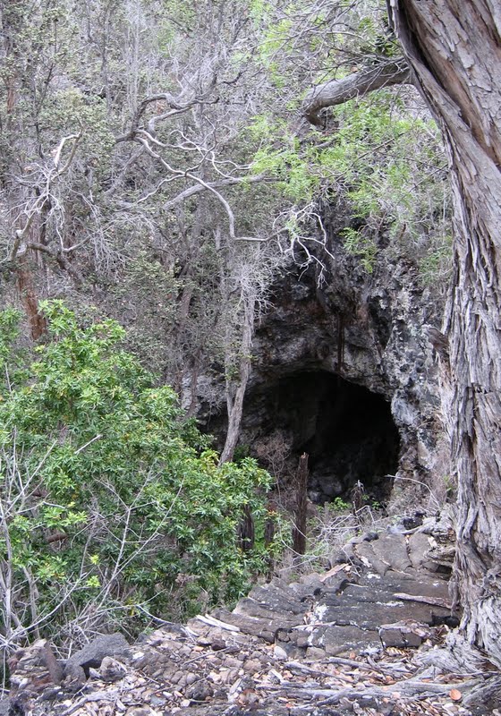
We travelled out of Hilo and first stopped at Akaka Falls State Park, a few miles off the main road, where we viewed an incredible waterfall.

We even caught the rainbow!

The area was very thick with vegetation so lush we could almost hear them growing.

Banana in flower

A paved path circles the park area

It cost $5.00 to enter the paved pathways that wound in a circular mile to view the natural phenomena from a distance. It was a real treat to drive down to the highway between the wide expanses of lime green grasses we had viewed coming in to Hilo. Before us, the Pacific expanded all the way back to Mexico.

Hamakua coastline - lots of lava, lots of lush

We continued up the Hamakua Coast enjoying the spectacular views from the cliffs. We looked down from a scenic site, then visited Laupahoehoe – a little village that had been tragically wiped out by a tsunami years before – a gorgeous spot.

Aerial view of Laupahoehoe

Breaking surf at Laupahoehoe

Rugged Laupahoehoe coastline

We continued on to the Waipi'o valley, also known as the "Valley of the Kings", at the end of the road, where ancient Hawai’in chiefs ruled among fields of taro rimmed by a black sand beach.

Waipi'o Valley

We were not allowed to descend into the valley without permission as the area is considered sacred, but were contented to observe it from a viewpoint high above the cliffs.

Taro fields of Waipi'o

As we drove along we considered the interesting history of this island, but before we could synthesize it, we needed to understand the how the language worked. There seems to be so many syllables and vowels in each word it is almost impossible to remember the name of anything and it seems EVERYTHING has a Hawaiian name. I discovered that until the American missionaries came to the islands in the 1820’s, the local inhabitants did not read or write their language – it was totally oral. One of the first things these Christians did was to change that and so introduced an alphabet which includes the vowels a, e, i, o and u, with only h, k, l, m, n, p, w. Every syllable in every word must be pronounced even when vowels come together. Unless specified, all stresses are placed on the second last syllable. Every time there is an apostrophe there is a glottal stop. Doug and I had a lot of fun sounding out the very long names for things, enjoying the way the vowels rounded and slipped off our tongues. Try this one: Kamehameha (who happens to be one of the greatest kings) or Lili’uokalani (a queen). Or perhaps a street name: Kanoelehua – which is how you get to the Hilo Airport. It’s fun.

From Waipi'o we continued along the Hawai’i Belt Road crossing through a wide expanse of pastureland into North Kahola passing through the cattle town of Waimea.

Range cattle - most of the ones we saw were black - Uncle Jack would know the breed

According to local lore, the first cowboys here came from Mexico (vaqueros, now called paniolo) to work with the cattle.
 
                                              Everyone loves cowboys

They brought their guitars with them which the locals adapted to flat-lapped haunting unique steel-sounding fretboard instruments.


The cattle were also foreign which went a long way to killing off endemic species as they grazed. Seven of them were a gift given to King Kamehameha by Captain George Vancouver in 1793 who promptly set them free. (I can just imagine the discussion about this gift. “What are these?” “What do we do with them?” “What weird creatures!” Let’s put them out back with the rest of the crazy stuff”) By 1809 they had reproduced so prolifically that they become pests and the King hired John Parker to manage the problem. Parker married into the royal family and within a short period of time he owned vast holdings and the Parker Ranch would become one of the largest in the world at 175,000 acres. We saw cattle spread all over the wide ranging and sun dappled network of sleeping volcano Mauna Kea’s slopes as we made our way through.

Range land around Waimea
We were pretty hungry by the time we made the turn off to follow the mountain road to the northern tip of the island at the old sugar plantation towns of Hawi and Kapa-au in Kuhala.


We ate lunch at Sushi Rock,


Do these people look happy?

consuming the best sushi roll I’ve ever had in my life: Marvellous Mango with real Wasabi. Wow!

The magnificent marvellous mango sushi roll

After a cup of 100% Kona coffee and sticky sweet at the funky Kohala Coffee Mill, littered with the kind of hide-out hippies from the 60’s we sometimes encounter in the islands of Georgia Strait, we continued south along the east coast to find the Nishimura anchorage.  We didn't actually get to it, but pulled in to a bay further to the south - it looked very remote and tiny, but calm.

We were pretty tired by now and still had a long way to go to get back to Ka'sala, so we continued on down the western coast a few more miles  before cutting across back to Waimea at Spencer Park Beach and back to Hilo. What a day!